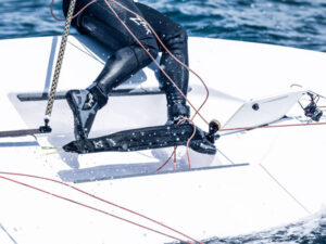
One of the coolest aspects of our data-rich world is the ability to send information over long distances. PredictWind, the New Zealand-based wind forecasting company, has long traded in their ability to deliver high-quality marine weather-forecasting tools and a curated selection of weather models. Now they’re pushing data farther offshore.
PredictWind’s DataHub ($300, plus $50 for an NMEA cable) is a GPS tracking system that allows friends and family to track your position, globally, via the vessel’s agnostic internet connection (e.g., Starlink, 3/4/5G/LTE or Iridium), but this only nicks the gelcoat of the DataHub’s capabilities.
The Automatic Identification System allows vessels to exchange navigation data—via VHF-FM frequencies—to avoid collisions. While AIS data is near real-time and extremely accurate, its reach is limited to line-of-sight ranges. Enter internet AIS data, aka over-the-horizon AIS.
For years, port authorities, government agencies, and private companies have built shore-based AIS receivers that collect AIS-VHF data from passing maritime traffic via tall antennas (read: far greater range than ship-to-ship AIS communications). This data is aggregated and sent to internet servers, where third parties can leverage it. Additionally, low-earth orbit satellites can receive some AIS transmissions, which they aggregate, process, and transmit to a ground station, which in turn pushes it to internet servers.
PredictWind acquires this data from third-party vendors and places it on servers where DataHubs can access it. Once downloaded, DataHubs convert internet AIS data into NMEA sentences, which allows a race boat’s networked chart plotter to juxtapose internet AIS-derived targets with AIS-VHF targets. DataHubs can also mimic terrestrial AIS stations, collecting your vessel’s networked AIS-VHF data and sharing it with PredictWind’s servers.
Internet AIS data, however, is older and less accurate than AIS-VHF data. For example, if there’s a delay of 15 to 30 minutes, a ship sailing at 18 knots will cover 4.5 to 9 nautical miles. Also, commercial-level Class A AIS transceivers broadcast at 12.5 watts every 2 to 10 seconds while underway; for comparison, Class B-CS broadcasts at 2 watts every 30 seconds, while Class B-SO broadcasts at 5 watts every 5 to 30 seconds. While these AIS signals are interoperable, power equals range, which means that Class A and Class B-SO broadcasts are often heard over Class B-CS messages.
Here it’s incumbent upon every navigator to understand the important differences between AIS-VHF and internet AIS data, and to treat internet AIS data with healthy skepticism. That said, DataHub users can set their range from 5 to 300 nautical miles, allowing navigators to monitor distant targets without overcluttering their screens.
Better still, DataHubs can also create automated AI polars. Here, DataHub collects information from the vessel’s NMEA network, which it sends to PredictWind’s servers, which, in turn, leverages AI to create bespoke polars.
Unlike polars that are created by a yacht designer, Nick Olson, PredictWind’s marketing business development manager, says that PredictWind custom-builds its polar based on how individuals sail their boats. These polars evolve as time elapses, however Olson doubts that the system could immediately detect if a crew blew out their headsail during a distance race. “Over time it would adjust, but not in the short term,” he says.
While some advanced features—including PredictWind’s proprietary over-the-horizon AIS data and automated AI polars—require a Pro-level PredictWind subscription, all users can leverage DataHub to track their vessel and monitor its live NMEA data globally. Additionally, DataHub provides firewall protection and optimizes email (read: compression), while its Anchor Alert App adds peace of mind for those on the hook.
So, if you sail with connectivity and are seeking a cost-effective way of tracking your boat while also accessing internet AIS data, automated AI polars, and other data-rich features, DataHub offers another tool to your race electronics toolbox.